
This was a murky day during a period when Britain was covered with dirty air that had come from the Continent. Visibility was about 15 km maximum, but the day had good cumulus in well formed streets. I declared an attempt on a long, thin triangle: Gransden Lodge, Edgehill, Bury St. Edmunds and home because the weather was coming from the west on a strong wind.
After launch I could not see Bedford from above Gransden Lodge, but the visibility looked just about usable, so I set off. My first good fix was over Silverstone, where I stopped directly over the circuit to take a climb. I could hear cars practising above the vario's beeping from 2500 ft and still hear them in the background from the top of my climb at 3500ft after drifting a kilometer away.
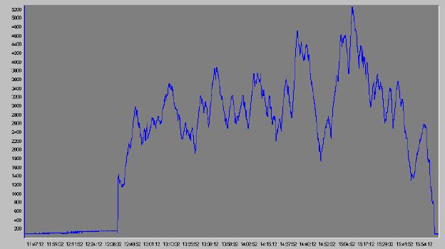
It was a very slow into wind slog to Edgehill. I rounded the turn point at a good height and then got low at Banbury, needing to scratch away from 1800 ft. I had a good run back across Silverstone, peaking at 5200 ft, but got low at Sandy, eventually scratching away from 1400 ft over some factory roofs and climbing back to 2600 ft. I didn't find any lift between there and Gransden Lodge. The clouds further east didn't look helpful, so gave it away and landed at GRL.
After landing I found that my Garmin II+ GPS was set to Garmin protocol when it should have been outputting NMEA 0183. As a result my logger only recorded height and ignored the data feed from the GPS. With no positions the attempt would have been no good for a 300 km claim anyway.
| Time | Declared | Leg (km) | Flown | Leg (km) | |
| Takeoff | 13:39 | GRL | |||
| Start | 13:50 | GRL | GRL | ||
| Turn point 1 | 15:38 | EDG | 93.75 | EDG | 93.75 |
| Turn point 2 | BSE | 150.87 | - | - | |
| End | 17:01 | GRL | 57.17 | GRL | 93.75 |
| Landed | 17:01 | GRL | |||
| Distance | 301.80 | 187.50 | |||
| Time | 3:22 | ||||
| Avg. speed | 55.7 kph |